
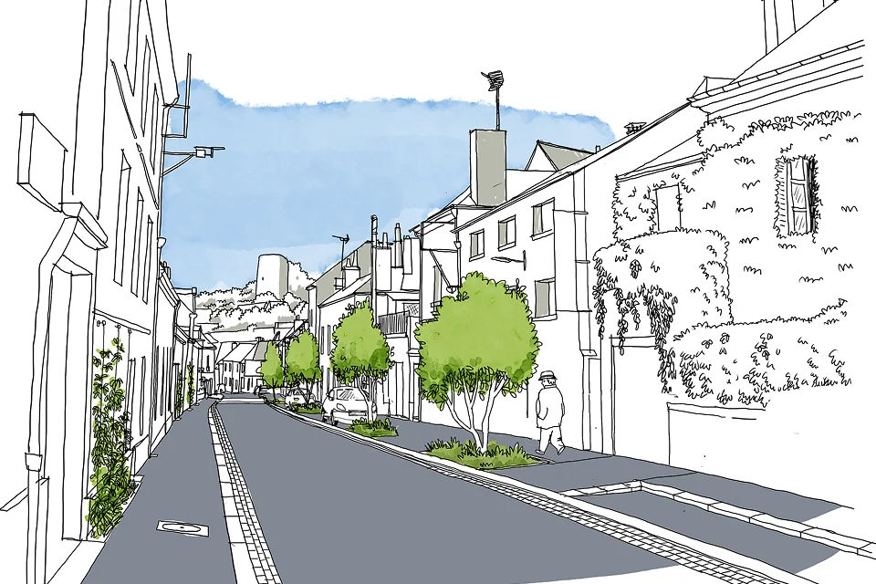
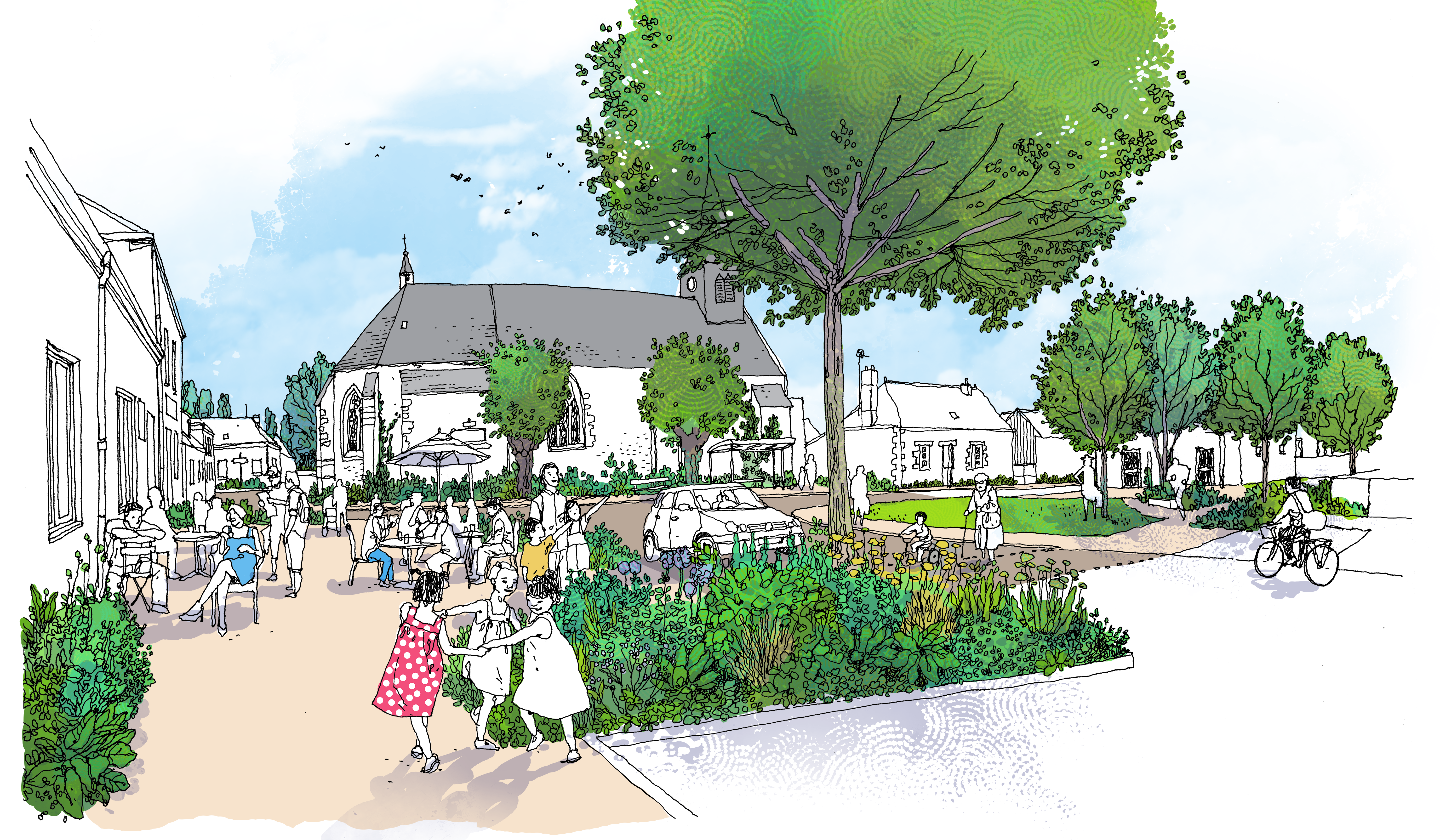
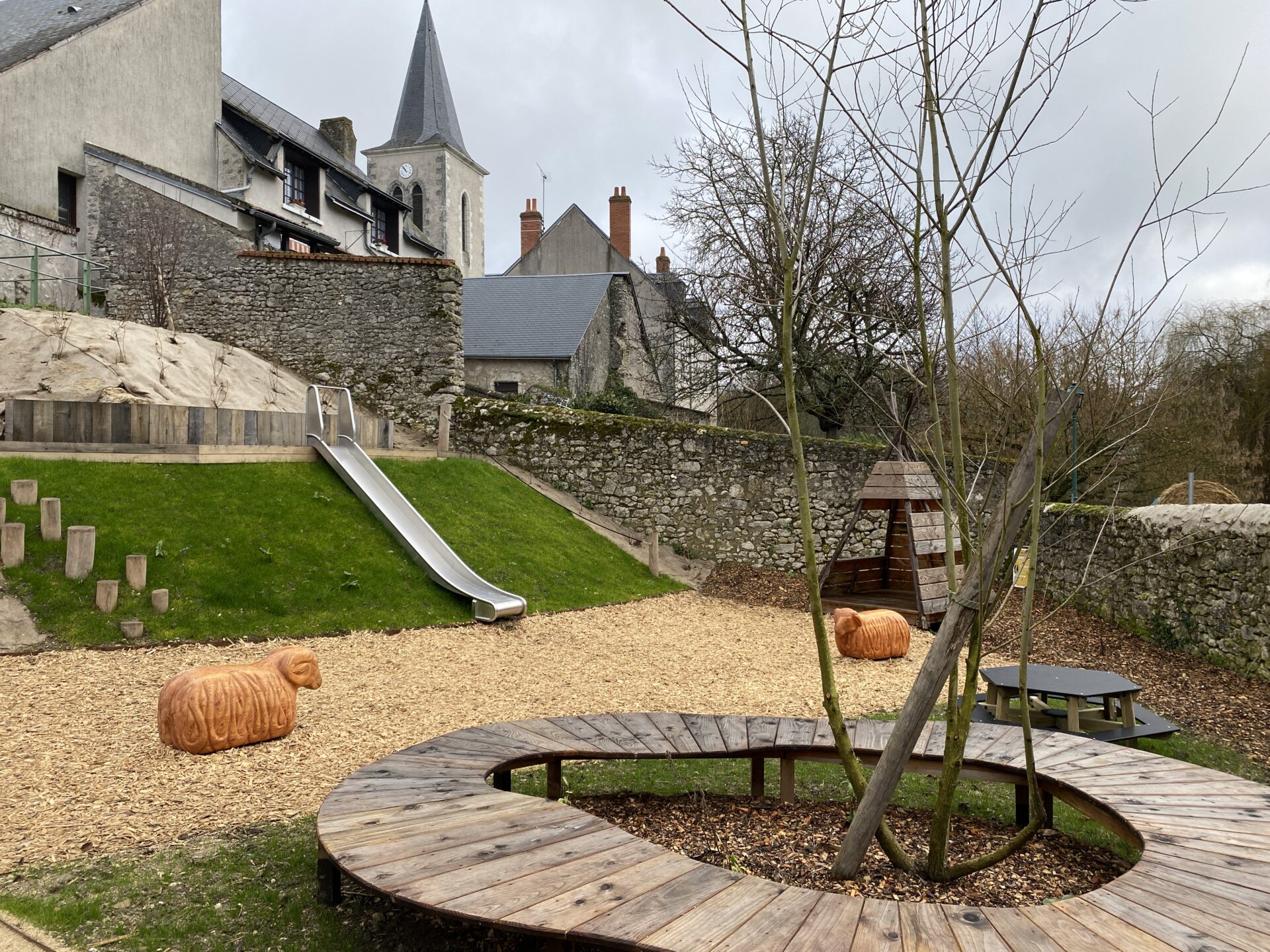
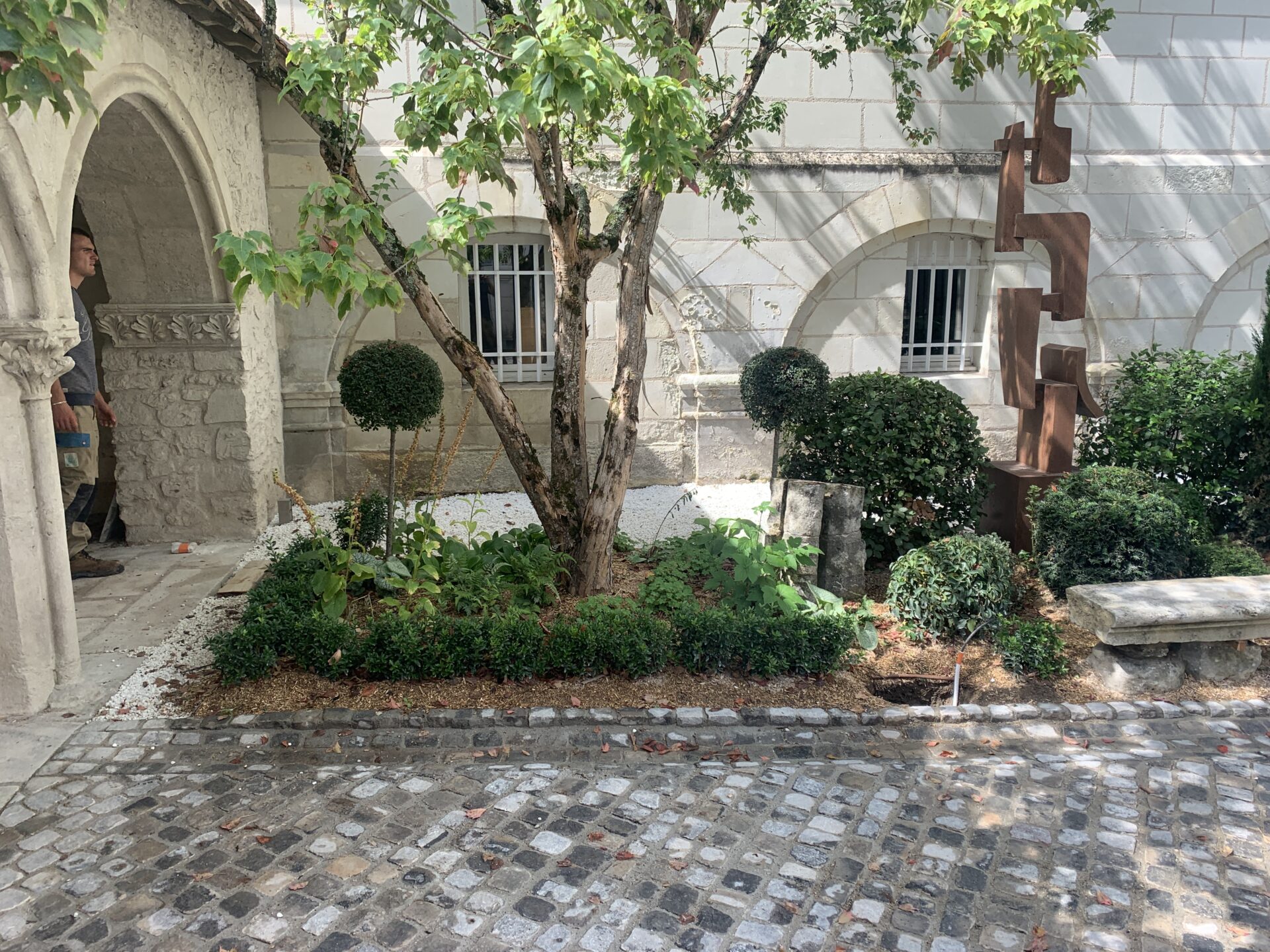
Nonancourt, 27
Un centre en harmonie avec son patrimoine moyenâgeux
Chambray-Lès-Tours, 37
Une transition sylvestre pour le centre-ville
Bourges, 18
Redonner une place à la ville pour s’ épanouir
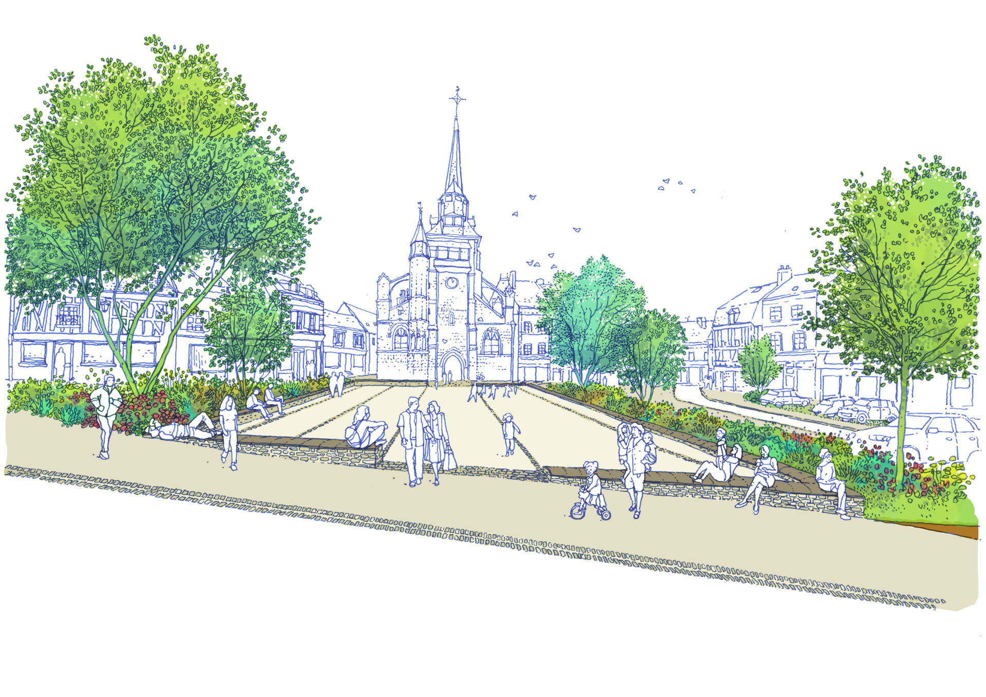
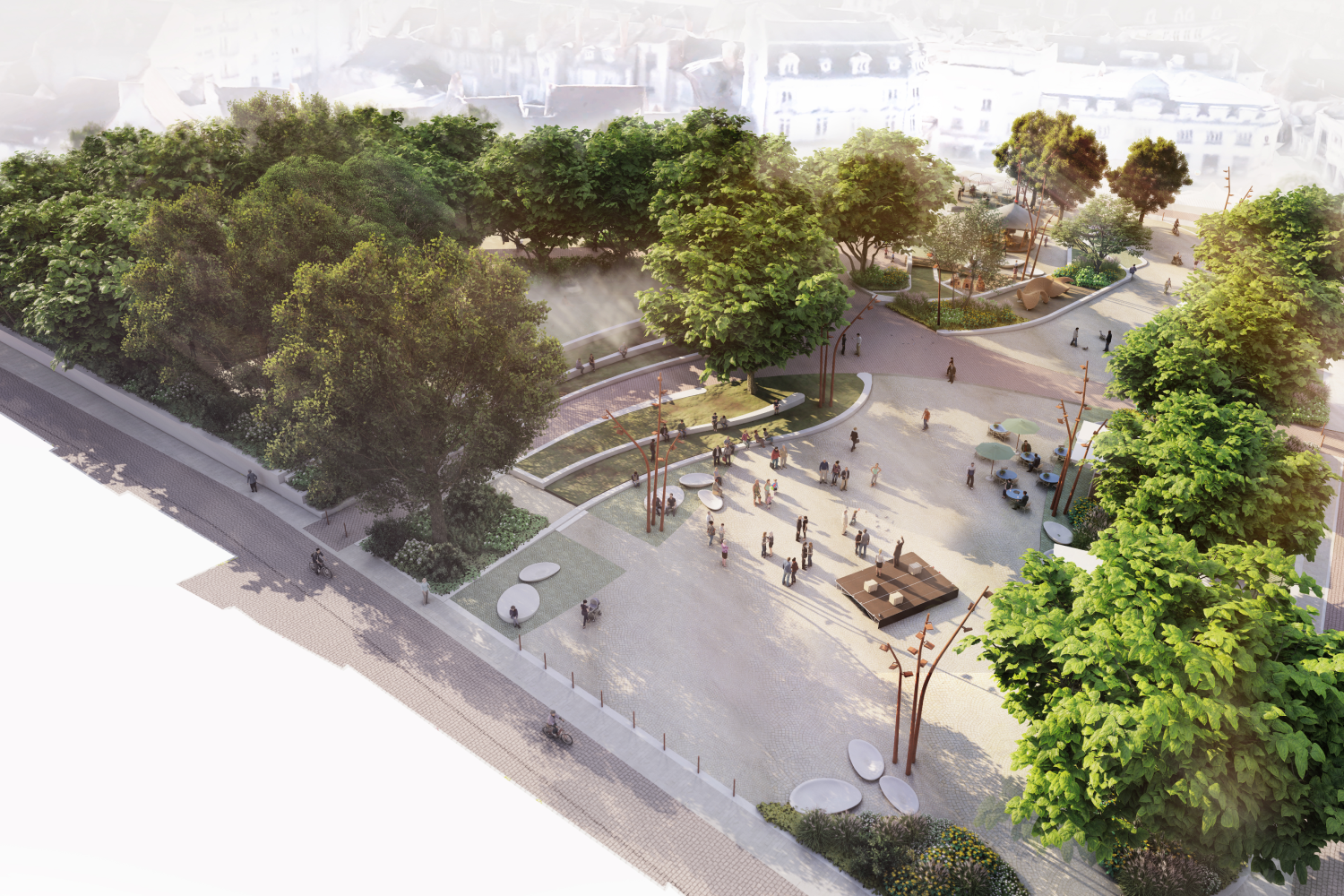
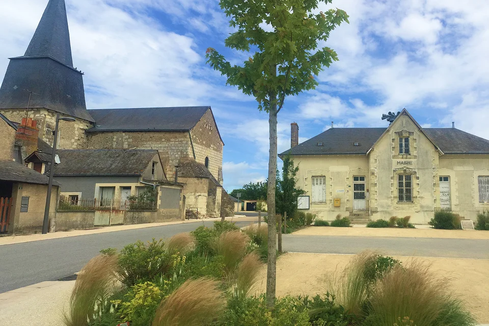
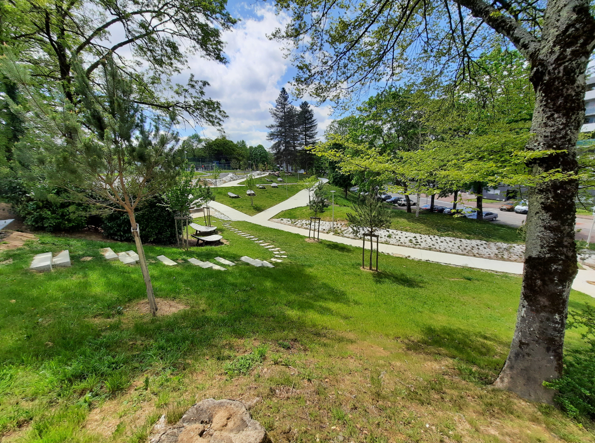
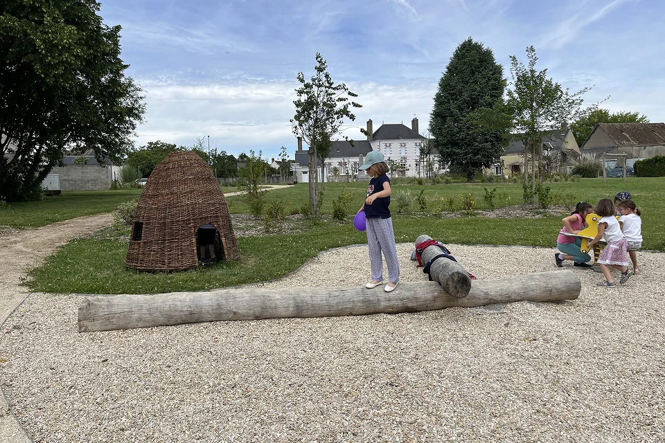
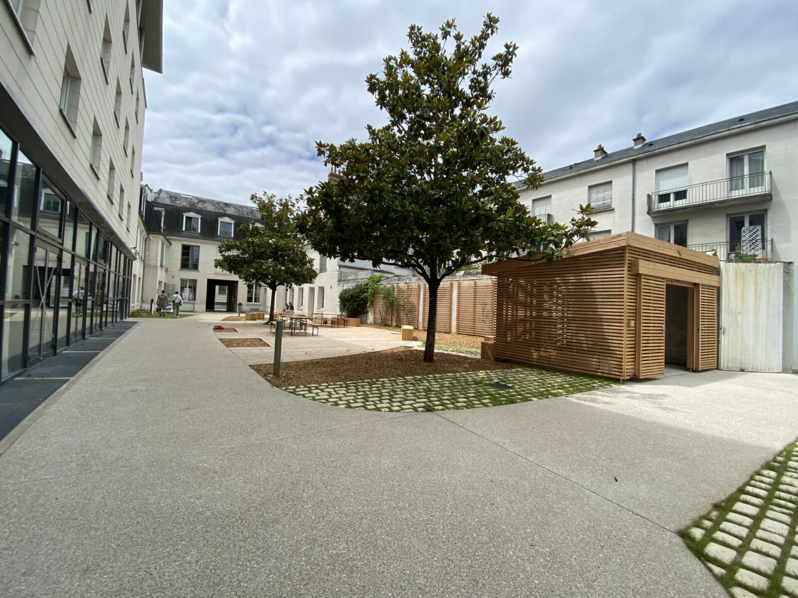
Blois, 41
Un centre-ville partagé dans un nouveau rapport à la Loire
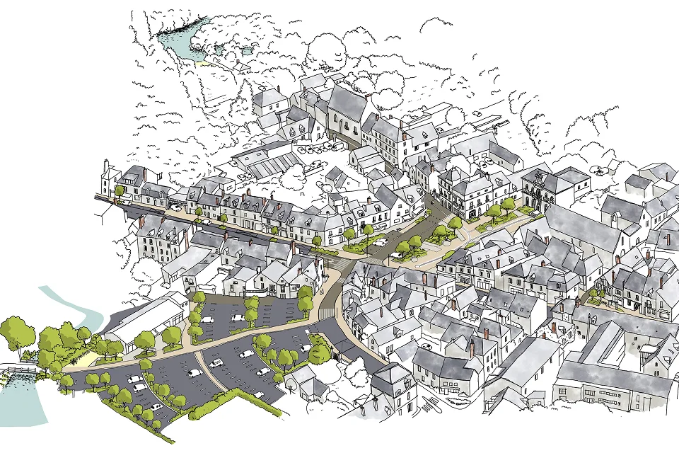
Château-Renault, 37
Un nouveau souffle pour l’axe central de la ville
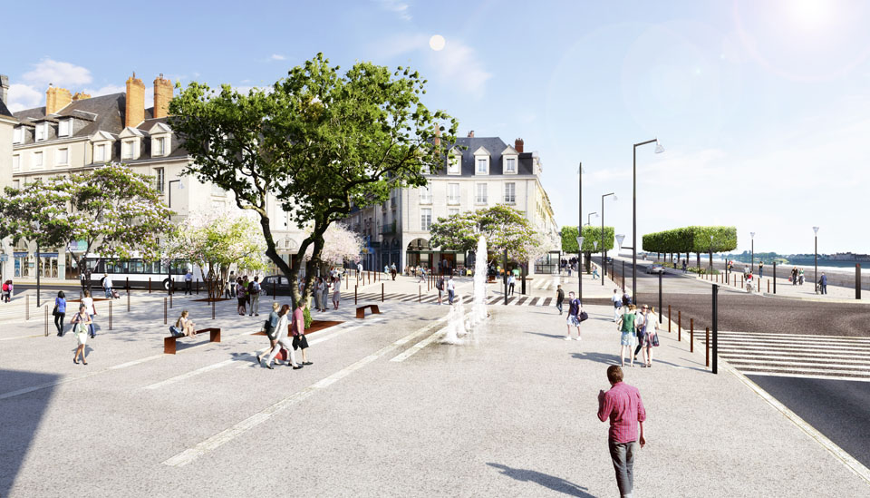
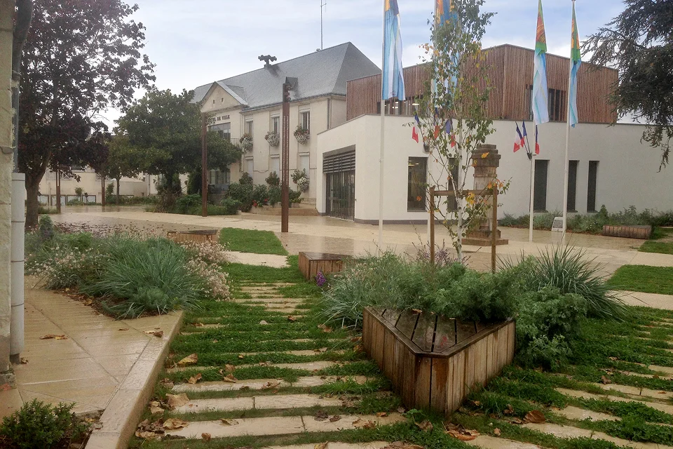
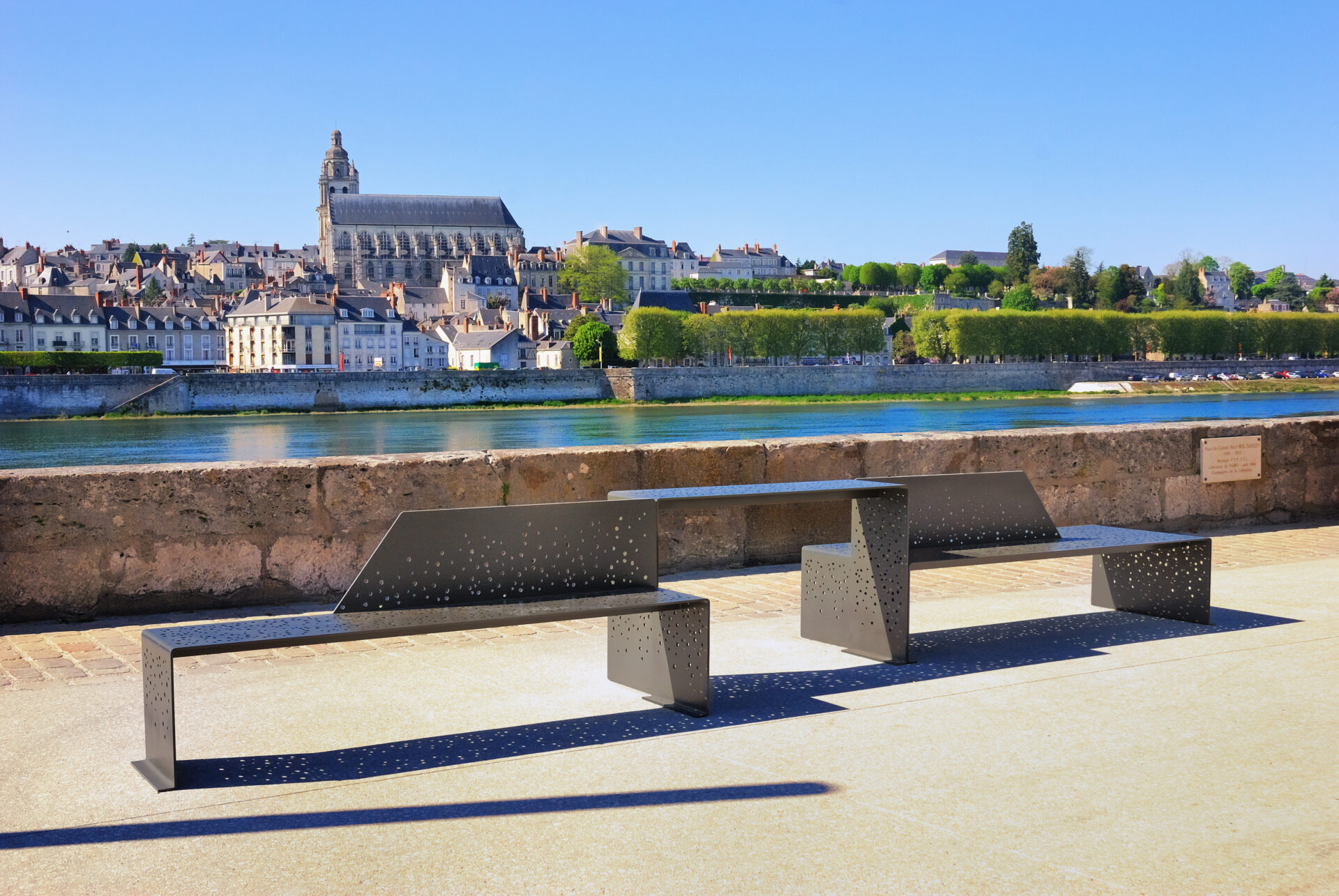
Blois, 41
Une place s’ouvrant vers le paysage remarquable de la Loire
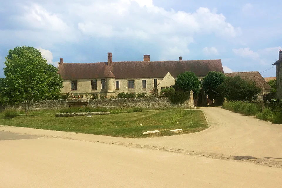
Montbazon, 37
Un centre patrimonial, commerçant et inondable
La Chaussée-Saint-Victor, 41
Un parvis convivial autour des commerces de l’Hermitage
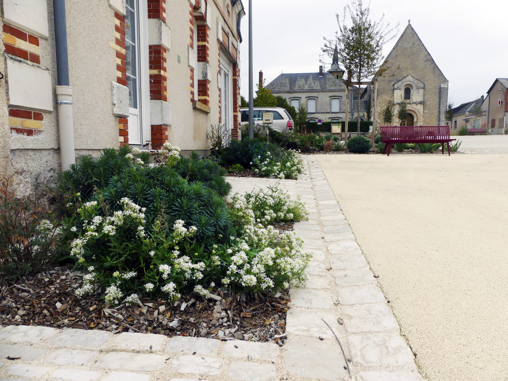
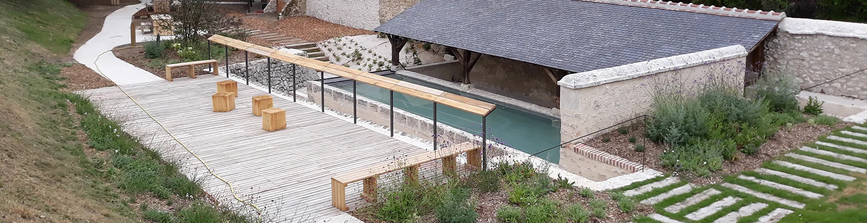
Vouvray, 37
La place Sadi Carnot tournée sur la vallée de la Loire
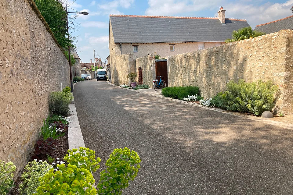
Veretz, 37
Quais apaisés et rue jardin au bord du Cher
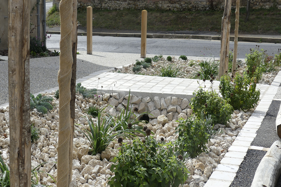
Villliers-sur-Loir, 41
Un village singulier animant les coteaux du Loir
Valaire, 41
Un lieu accueillant entre l’église et le lavoir du village
Selommes, 41
Un centre-bourg patrimonial à révéler
Omerville, 95
Un centre bourg infiltrant au coeur du PNR du Vexin
Montlivault, 41
Abords de la mairie dans un bourg patrimonial du val de Loire
Ecoman, 41
Une placette de Mairie d’un village traversant
Courcelles, 37
Un coeur de village vivifié offrant une centralité piétonne
Cheillé, 37
Une traversée de village sur le coteau d’Azay-le-Rideau
Bauzy, 41
Pour un espace public qui parle de son territoire de Sologne
Avoine, 37
Une place de marché et un square traversés et perméables
Avrillé-Lès-Ponceaux, 37
Un centre-bourg rural requalifié et apaisé
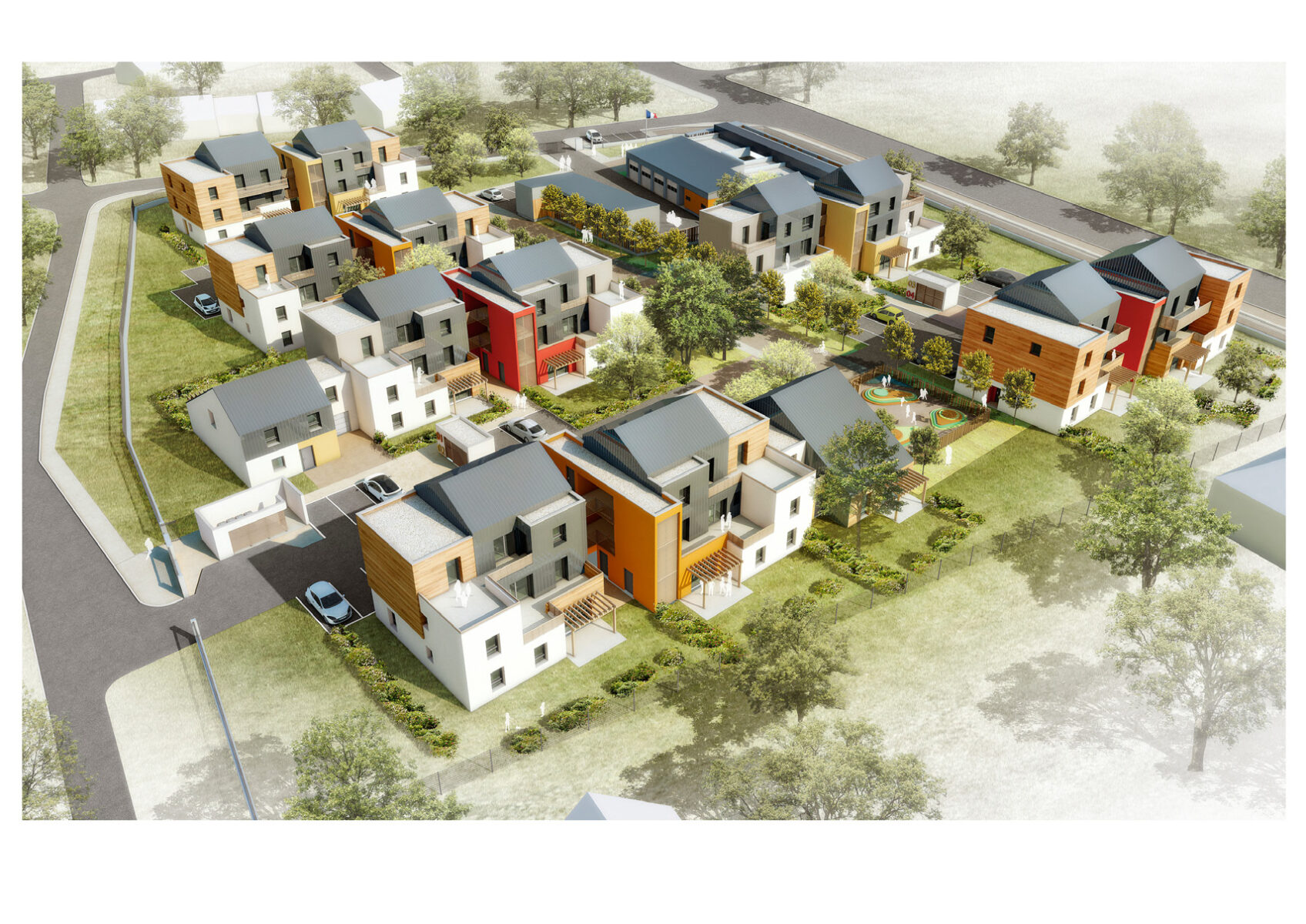
Saint-Laurent-Nouan, 41
Une caserne intégrée à son environnement
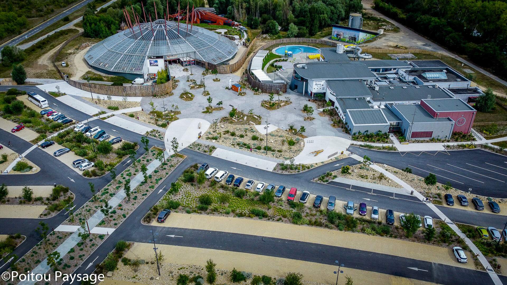
Saintes, 17
Une transition champêtre pour le quartier de la Guyarderie
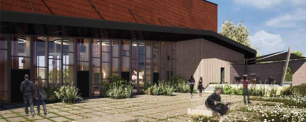
la Chapelle Vendômoise, 41
Une salle polyvalente à vocation socioculturelle et événementielle
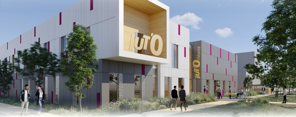
Orléans, 45
Un nouveau bâtiment administratif pour l’IUT d’Orléans
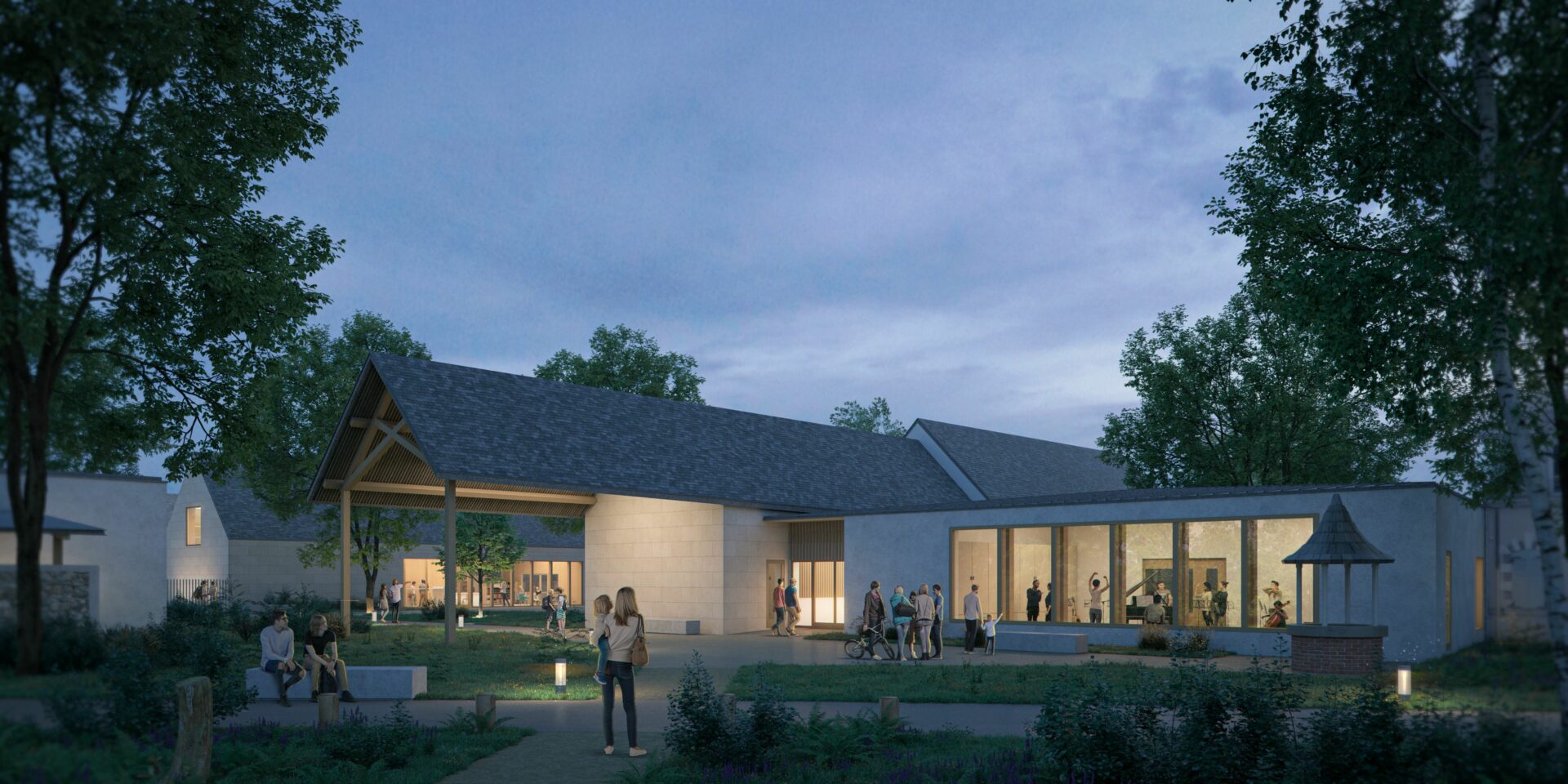
Ingré, 45
Un pôle culturel au coeur d’un parc historique
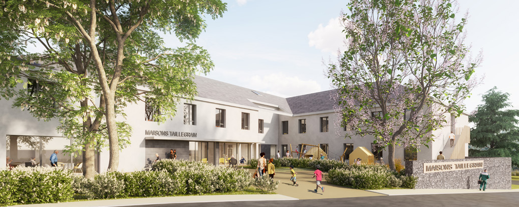
Bourges, 18
Un jardin arboré pour les résidents de l’EHPAD Taillegrain
Chécy, 45
Une médiathèque dans un jardin
Le centre de loisirs
l’articulation entre la ferme et le parc
Montoire-sur-le-Loir, 41
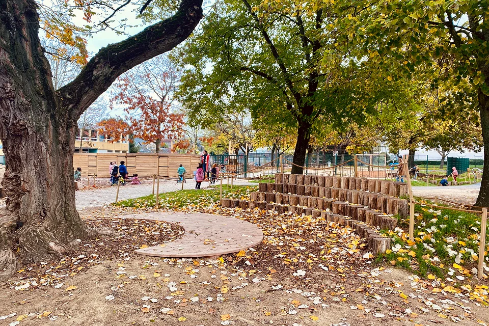
La cour des 4 saisons, pédagogie et biodiversité
Vineuil, 41
L’école des Noëls renaturée
Vineuil, 41
Re-aménagement de la cour d’ école des Girards et de l’ ALSH
Saint-Pierre-des-Corps, 37
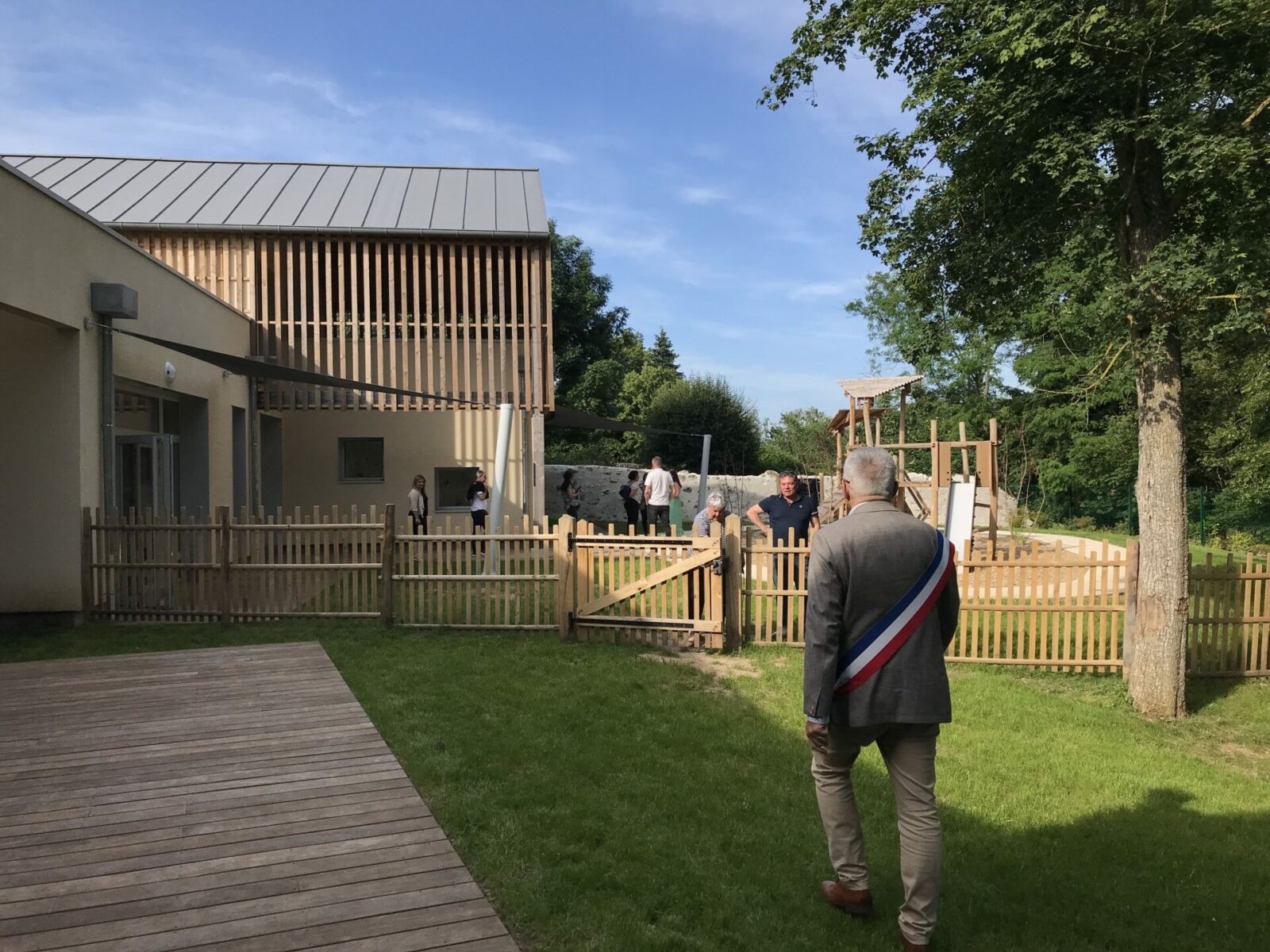
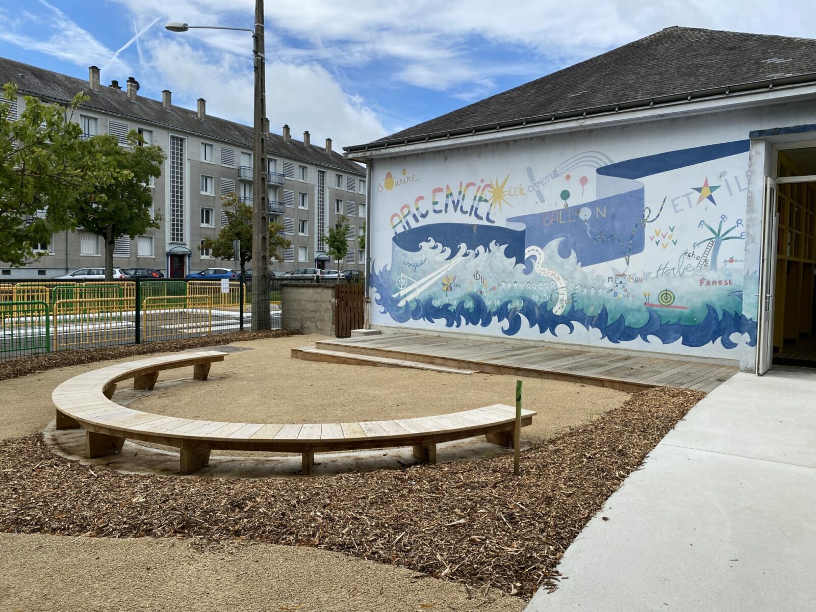
Un univers ludique et naturel pour l’école maternelle Stalingrad
Saint-Pierre-des-Corps, 37
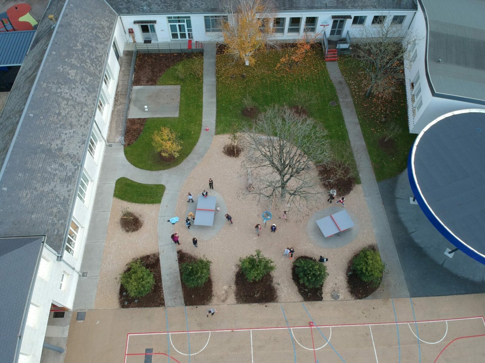
Renaturer la cour du groupe scolaire Marceau Paul-Louis Courier
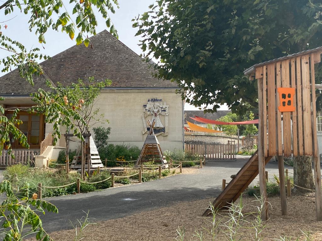
Saint-Aignan, 41
Désimperméabiliser les cours en terrasses
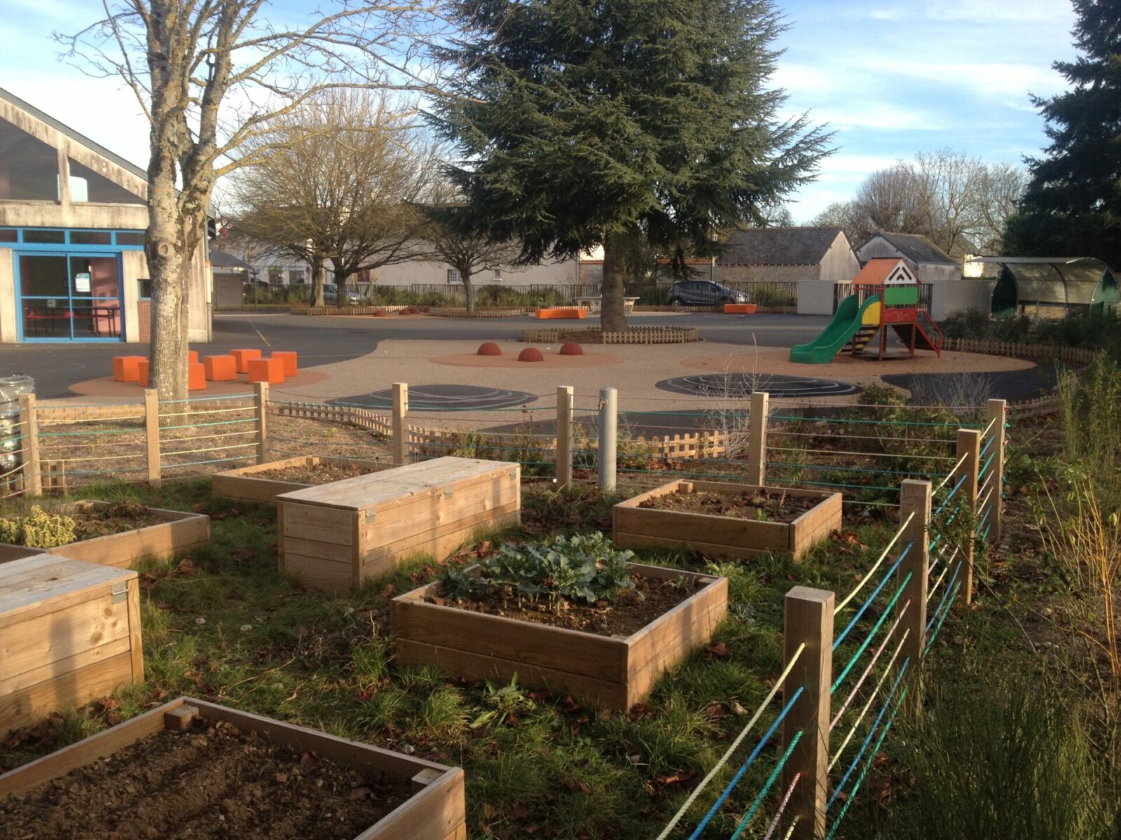
Fossé, 41
Une cour ludique et un jardin pédagogique pour l’école
Vineuil, 41
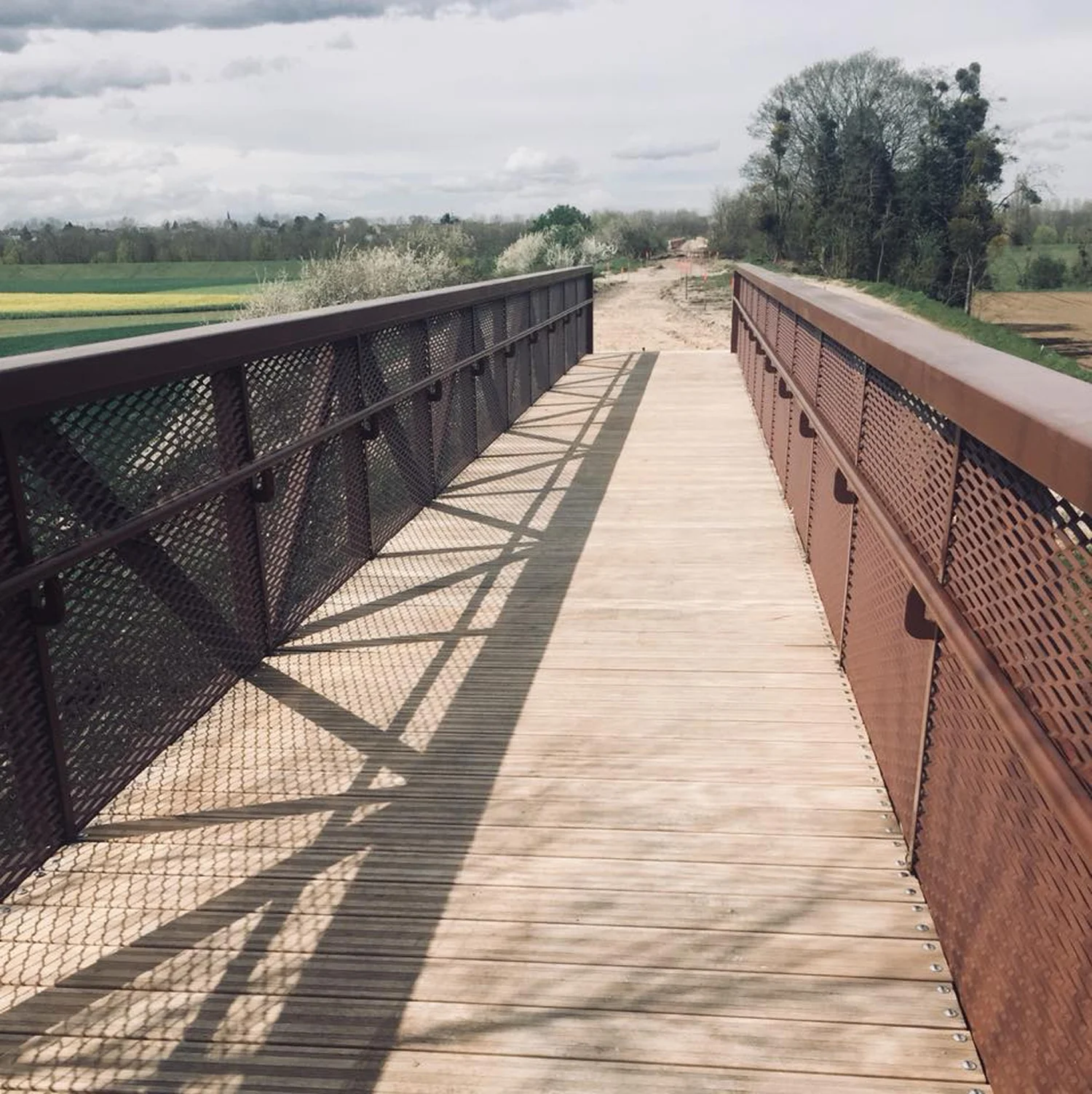
Valorisation d’un ancien viaduc ferroviaire
Mesland, 41
Un jardin avec vue sur le val de la petite Cisse
Mer, 41
Un parc Nature au coeur de la ville
Montrésor, 41
Une promenade sur les balcons de l’Indrois
Limoges, 87
Le Parc des étoiles, Un poumon vert sur le site des anciennes tours
Lestiou, 41
Le clos ludique
Civaux, 86
Un parc dans les méandres du Dragon
Chenonceaux, 37
Un jardin secret dédié à l’histoire des pivoines
Chemillé, 37
Un nouveau souffle pour le lac
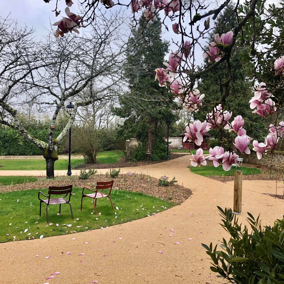
Chaumont-sur-Loire, 41
Aménagement des bords de Loire
Bléré, 37
Un parc de loisirs naturel sur les rives du Cher
Billy, 41
Un parc de loisirs au coeur du bourg
Autainville 41
Aménagement des espaces de loisirs
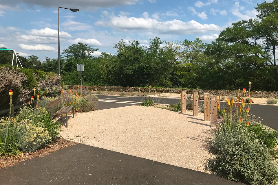
Saint-Hilaire-la-Gravelle, 41
Un jardin pédagogique entre gare et école
Savigny-en-Véron, 37
Une ambiance intimiste pour le jardin de l’ancien presbytère
Blois, 41
Nourrir la ville, pour un maraîchage urbain attractif
Ménars, 41
Valorisation d’un ancien lavoir en aire d'accueil de la Loire à vélo
Saint-Laurent-des-Eaux, 41
Un square arboré au coeur de la centrale
Blois, 41
Une reconversion d’un bâtiment et de son parc historique
Romorantin-Lanthenay , 41
Un jardin d’inspiration Art-Déco
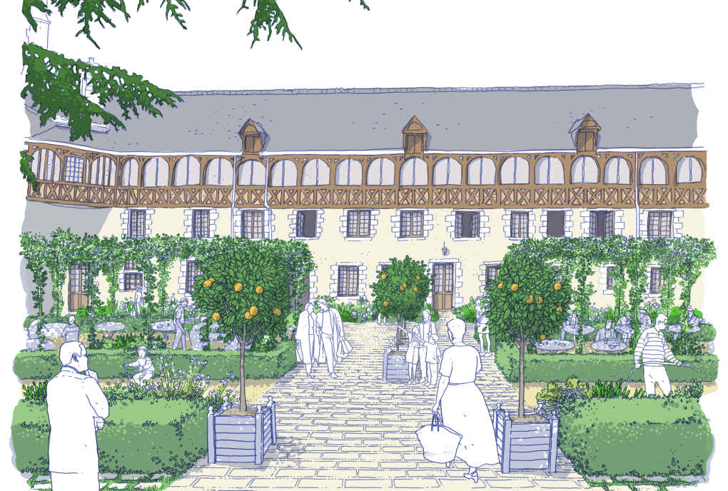
Blois, 41
Le Jardin de l’Oratoire à l’Orangerie du Château
Fougère-sur-Bièvre, 41
Un patio planté au coeur du nouveau siège social
Blois, 41
Un esprit de Loire au coeur d’un hôtel historique
Azé, 41
Renaissance des jardins et fontaines du château de Courtozé
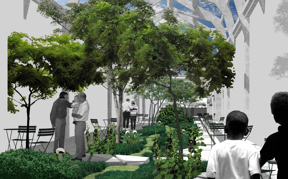
Tours, 37
Des cours accueillantes pour le foyer de jeunes travailleurs
Tours, 37
Redonner une âme à la cour d’un hôtel particulier historique
Chaumont-sur-Loire, 41
Lucy* in the sky
Saint-Chartier, 36
Un parc autour des contes de fées
Vineuil Boisjardin, 41
Une promenade comme coeur de quartier
Thivars, 28
Habiter en lisière et s'ouvrir vers les champs
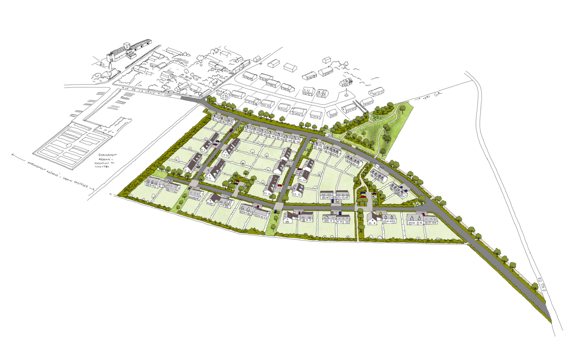
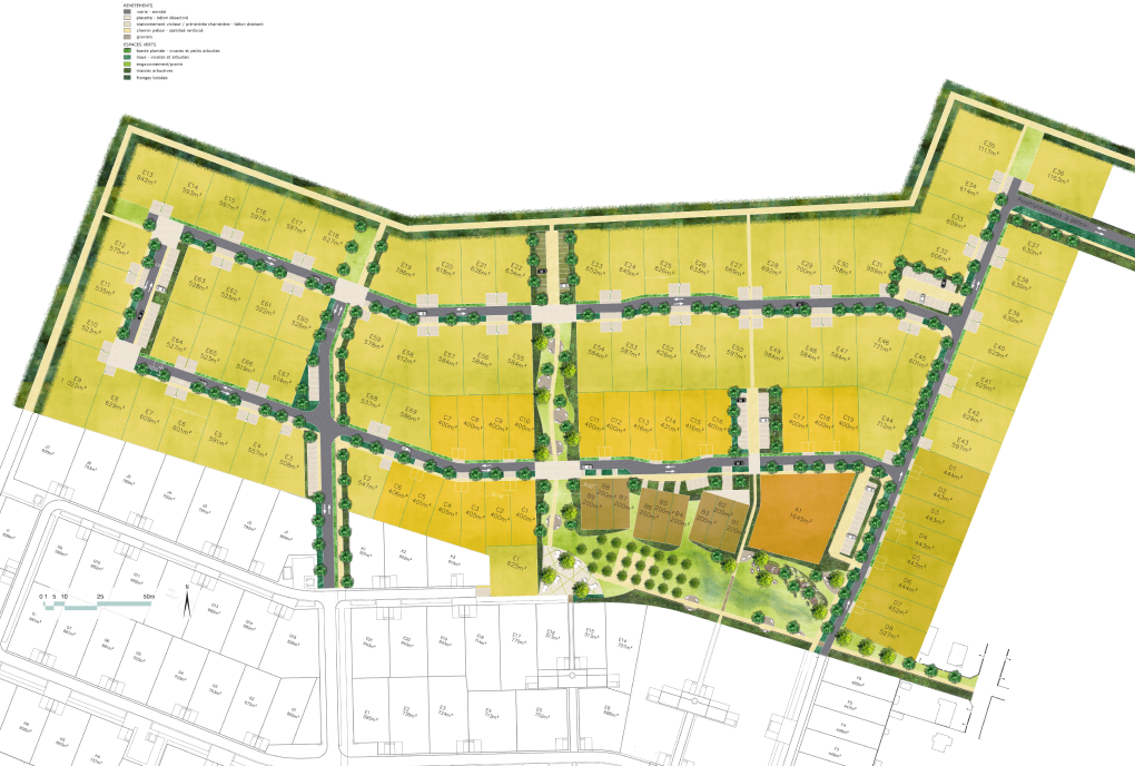
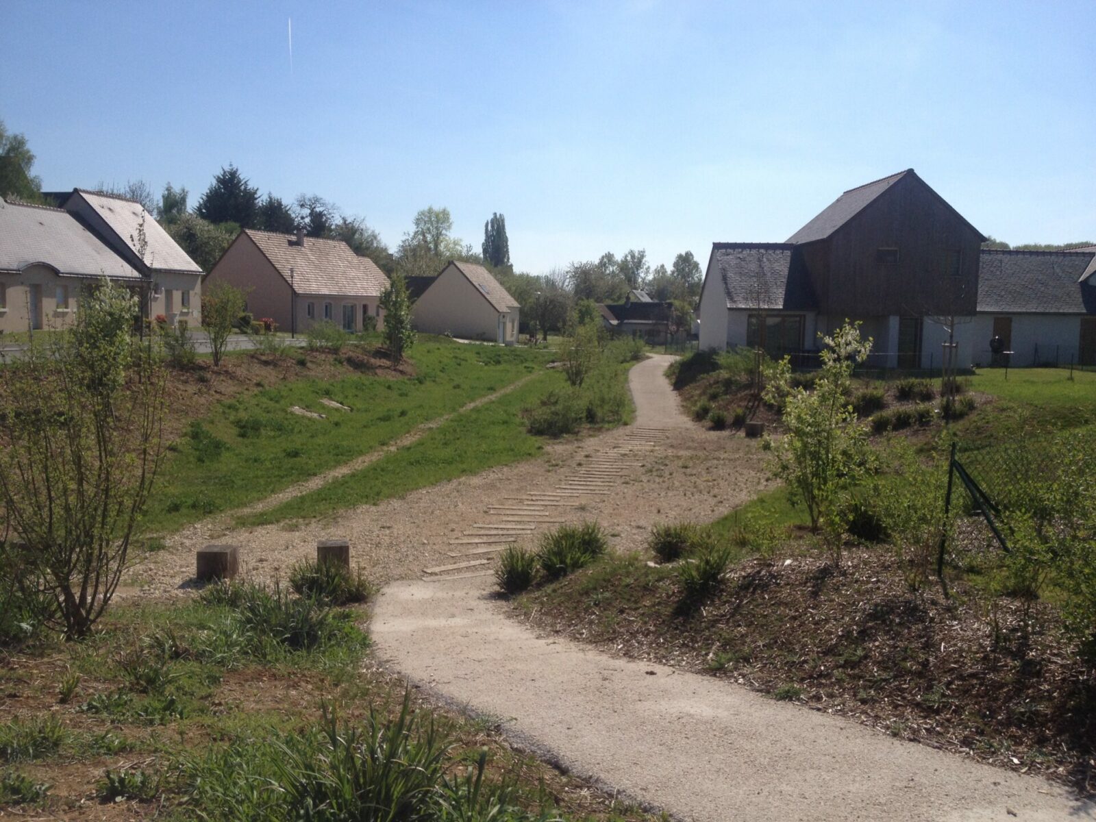
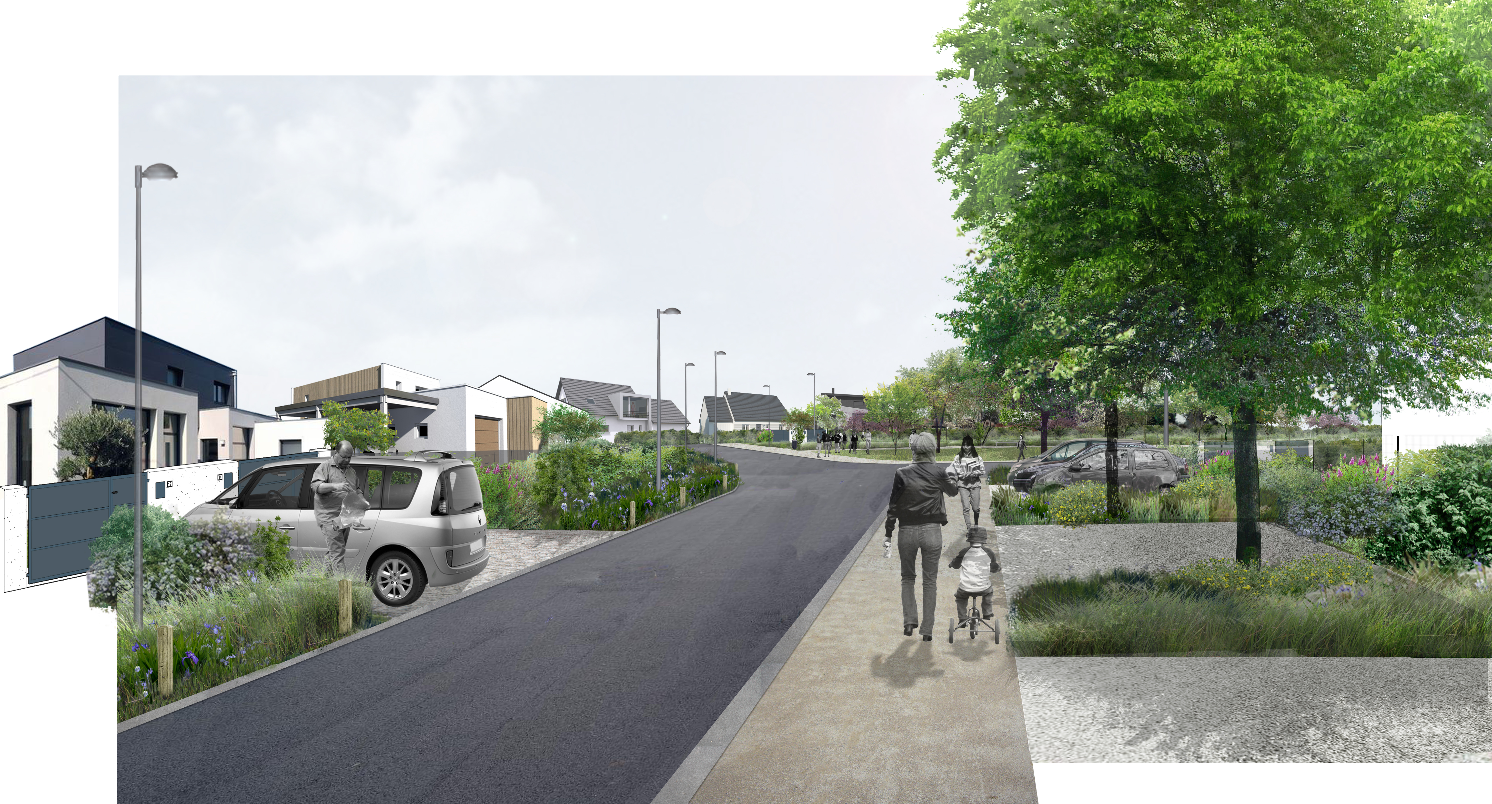
Semblançay, 37
Habiter entre la petite Choisille et le bourg
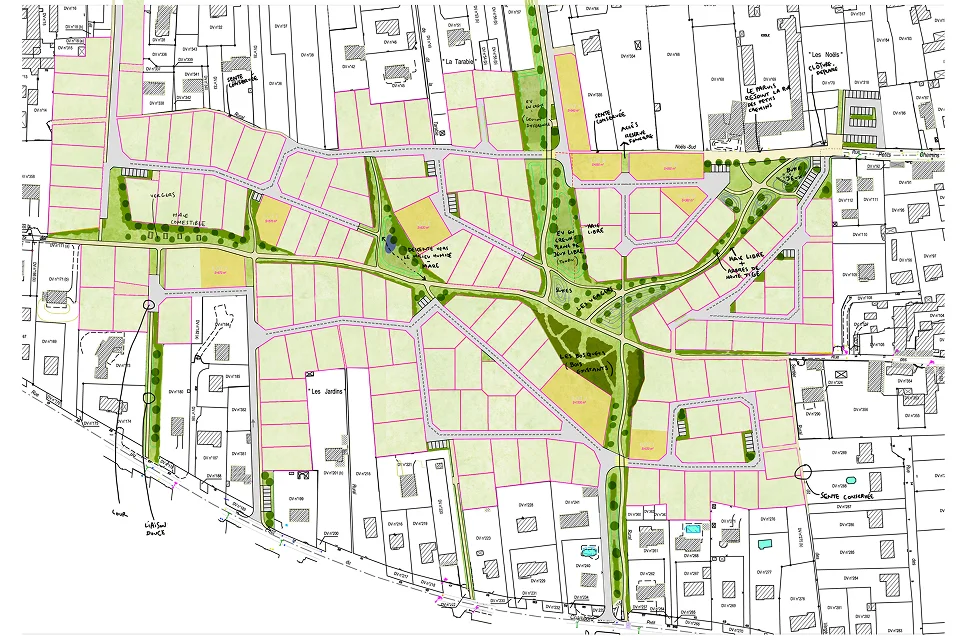
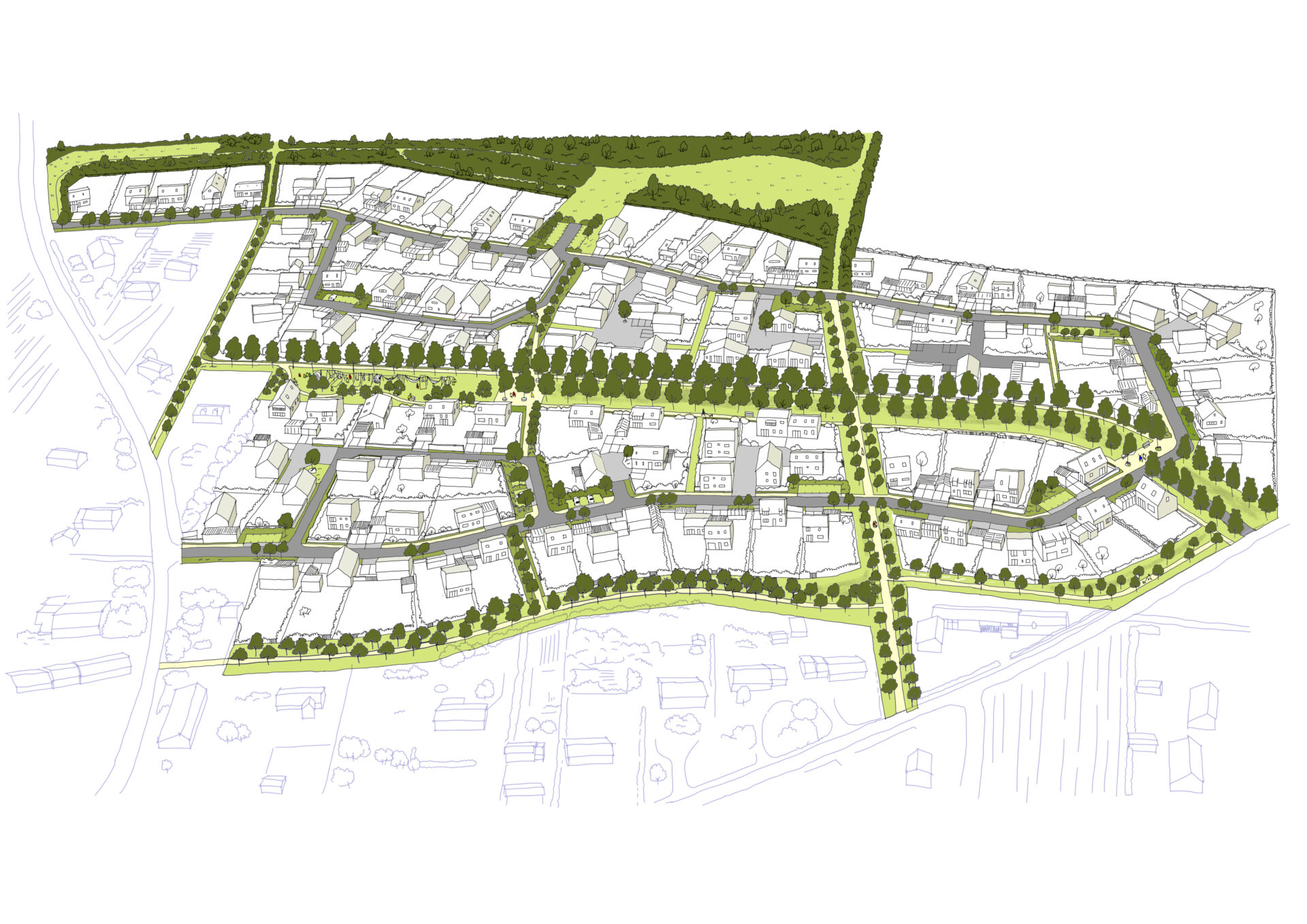
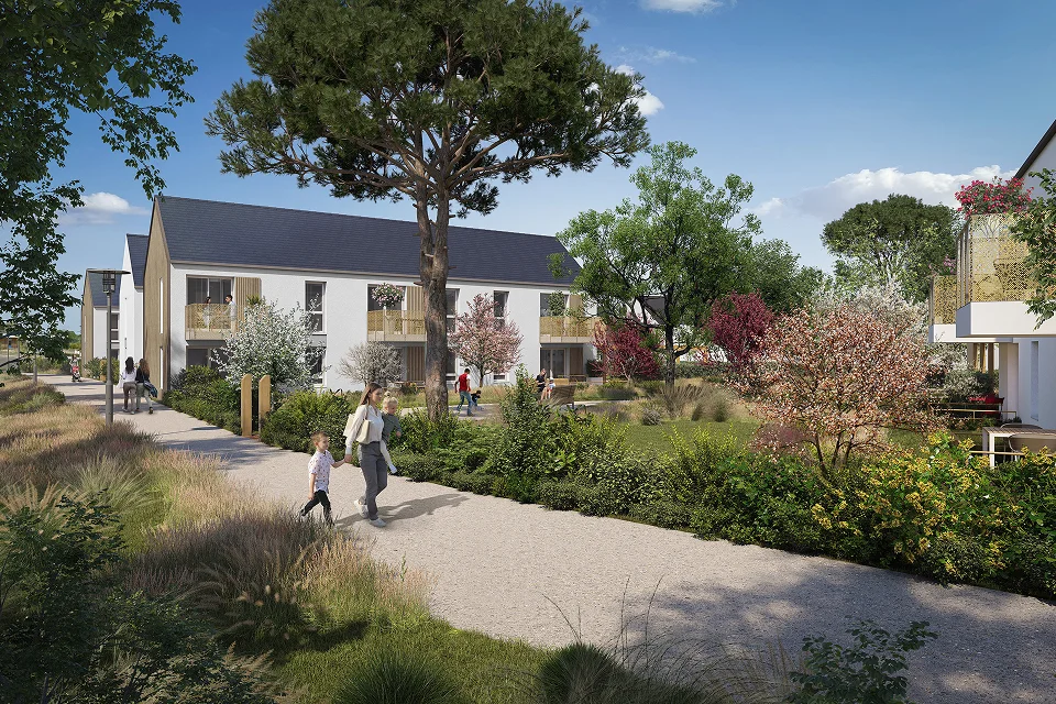
Saint-Ouen, 41
Construire la ville de demain à Saint-Ouen
Saint-Georges-sur-Eure, 28
Préserver un environnement rural privilégié
Nouzilly, 37
Intégrer l’eau dans un espace public rural
Molineuf, 41
Pour une densité et un espace public adaptés à la campagne
Huisseau-sur-Cosson, 41
Un quartier résidentiel au caractère affirmé
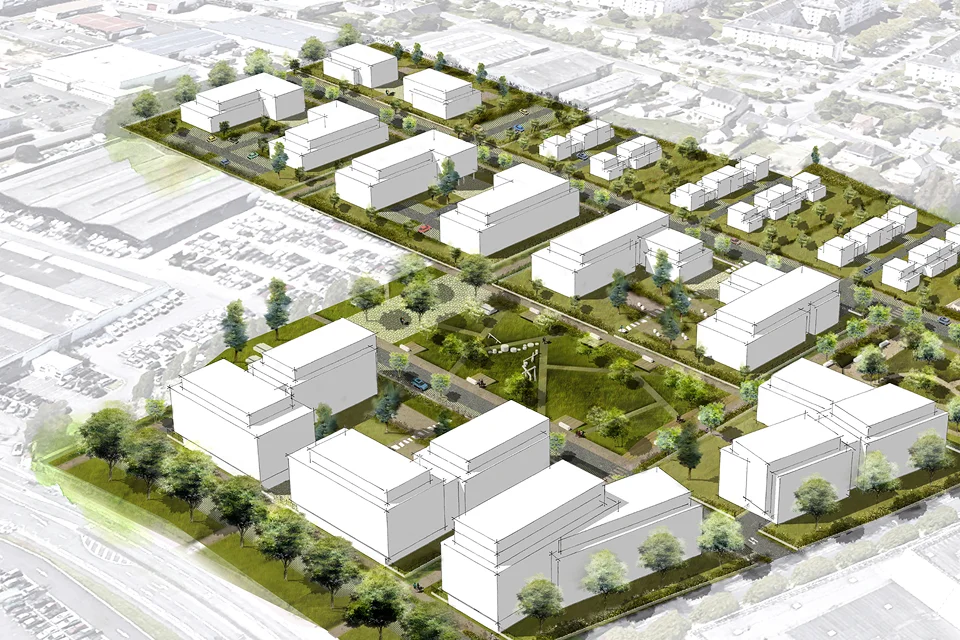
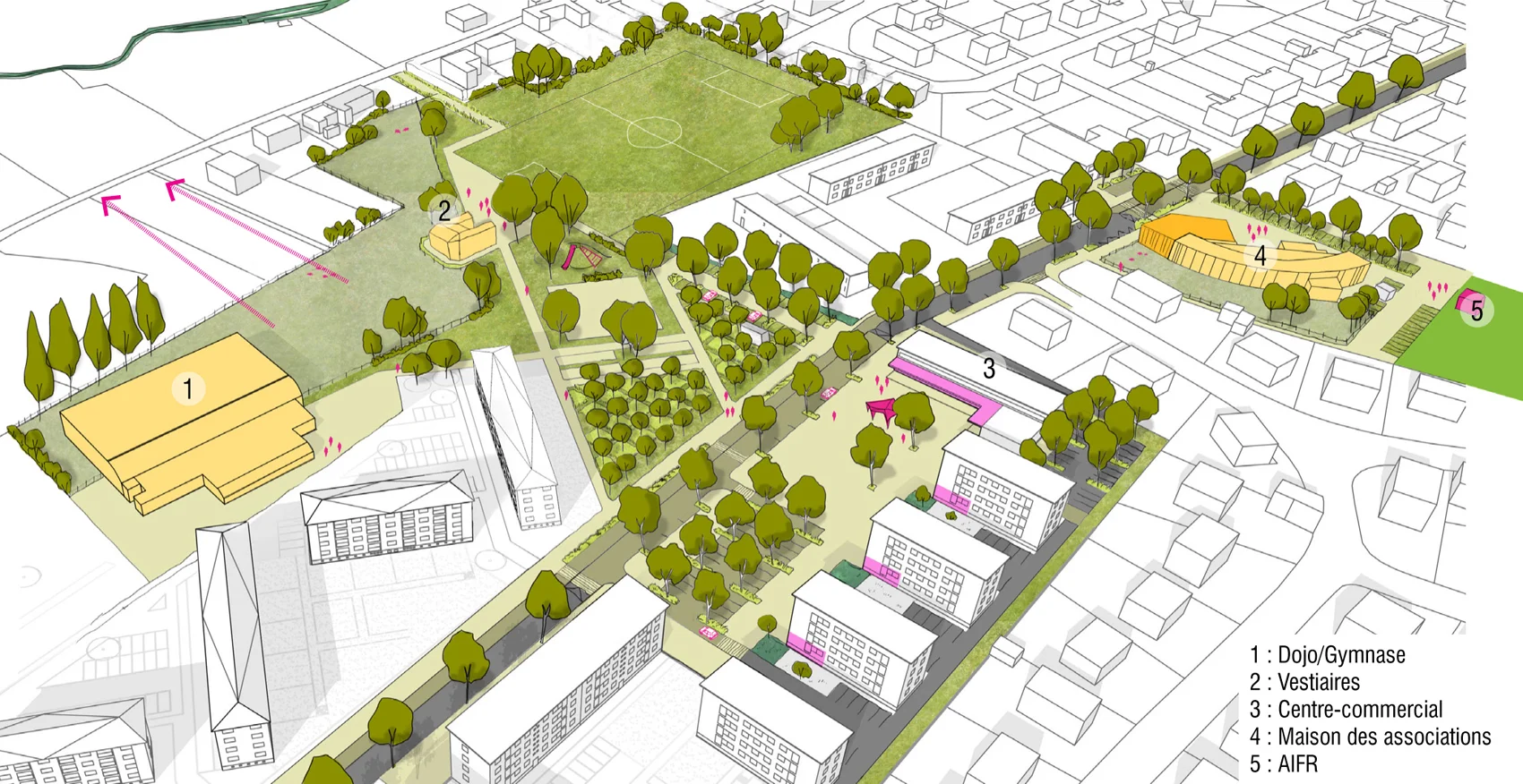
Dreux, 28
Un quartier de vie durable sur un ancien site industriel
Le Mans, 72
Un jardin habité au coeur de la ZAC de la Cartoucherie
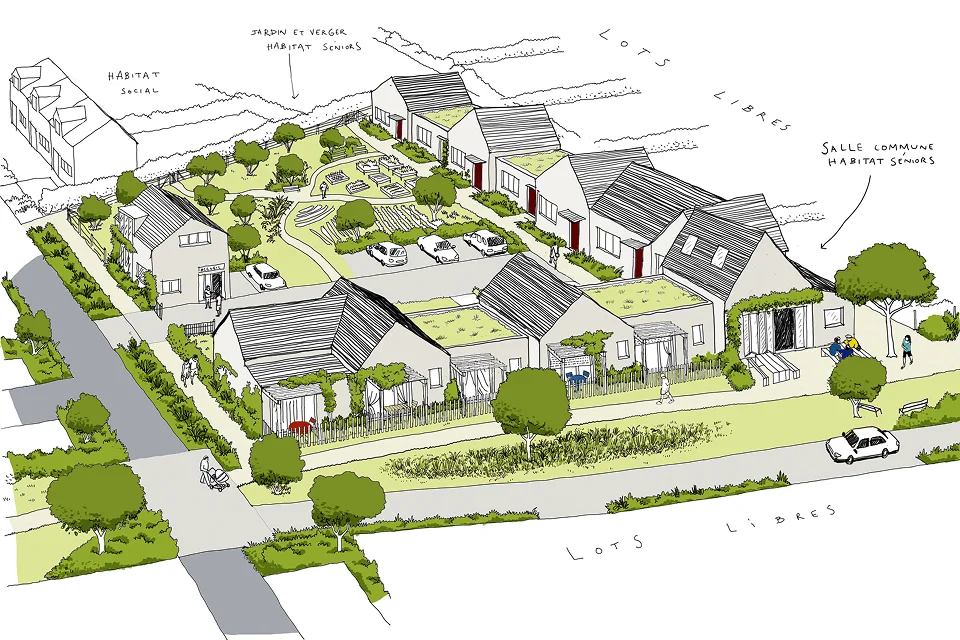
Guérêt, 23
Réenchanter les pieds d’immeubles avec les habitants
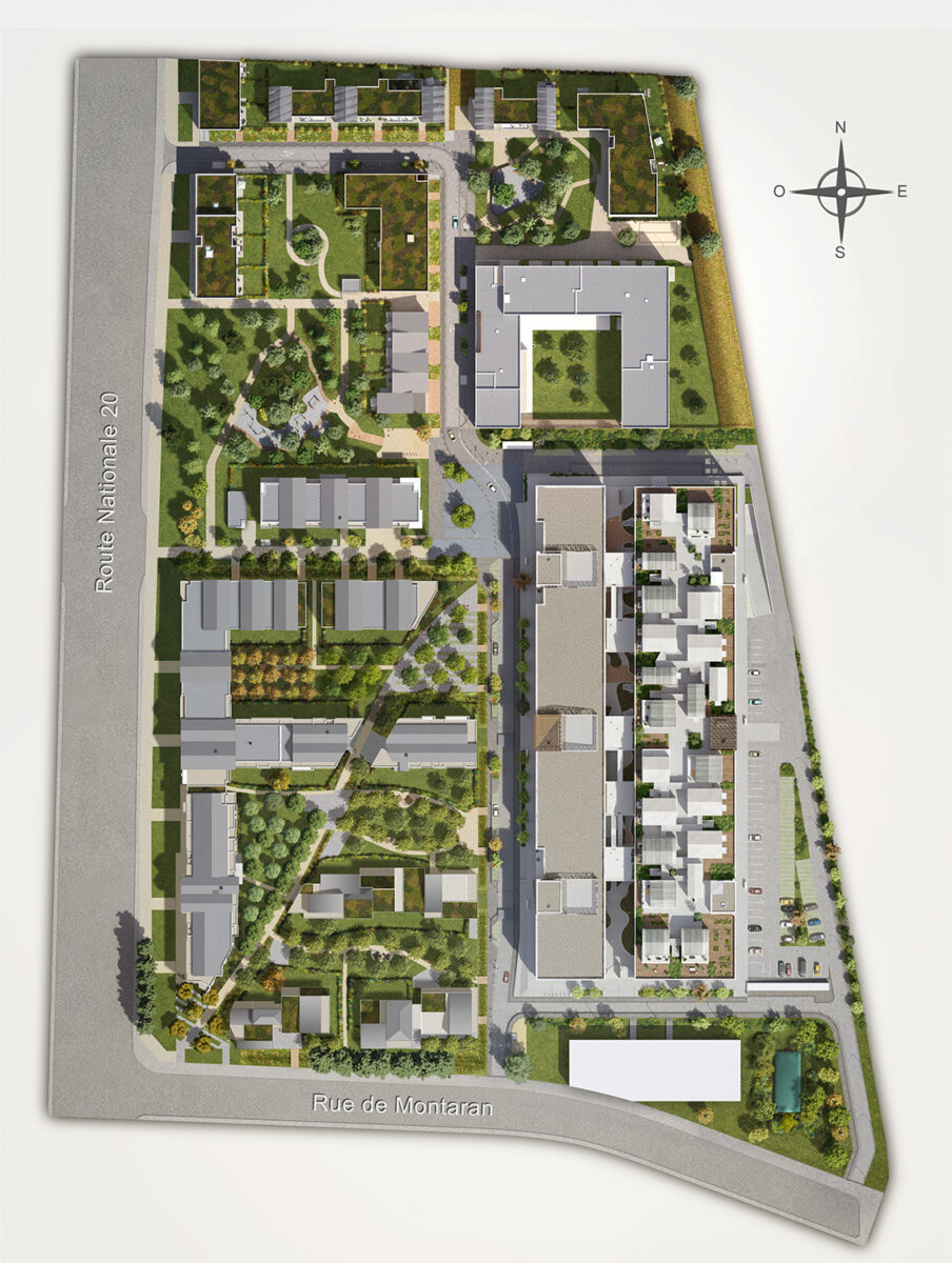
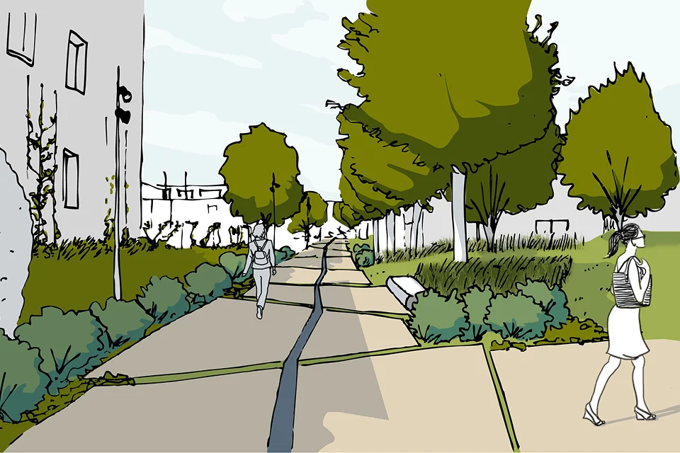
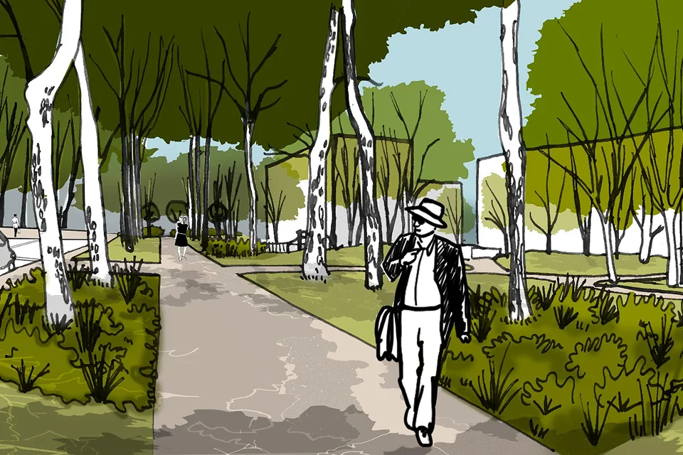
Tours, 37
Une ville dans un jardin
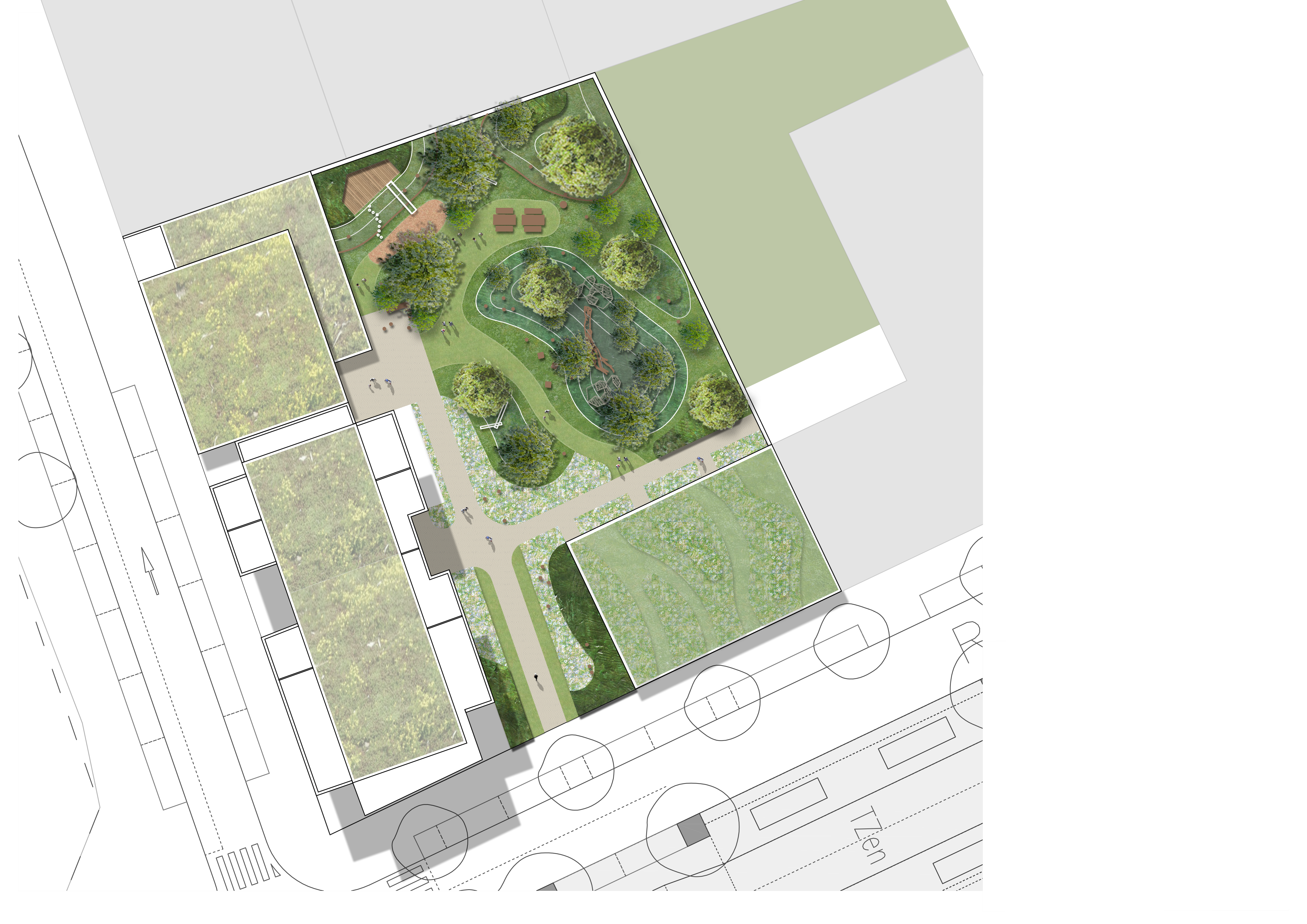
Vitry, 94
Aménagement d’un coeur d’îlot vivant et perméable
Trélazé, 49
Un projet de renaturation pour la manufacture d’allumettes
Tours, 37
Un coeur d'îlot ligérien
Saran, 45
Réenchanter le quartier des Chimoutons
Saran,45
Réhabiliter la friche Quelle vers un jardin habité
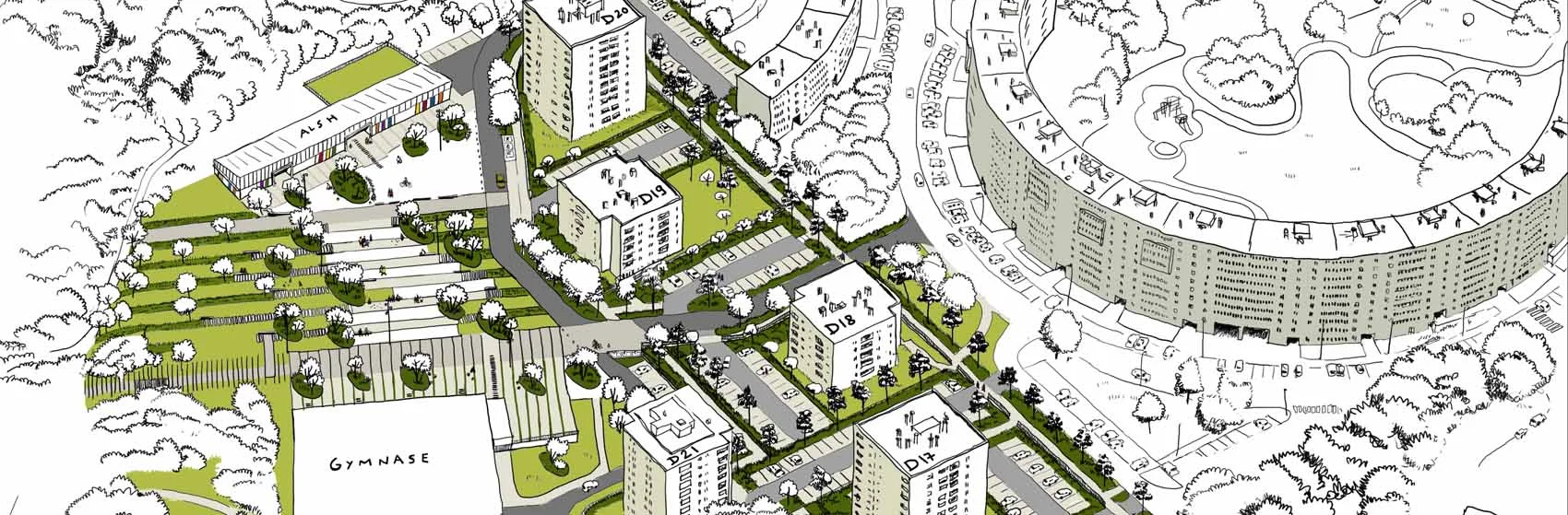
Noisiel, 77
Réconcilier le quartier des deux parcs avec sa dalle
Mantes-la-jolie, 78
Renouveler le quartier autour de son coeur boisé
Flers, 61
Un renouvellement urbain en lisière rurale
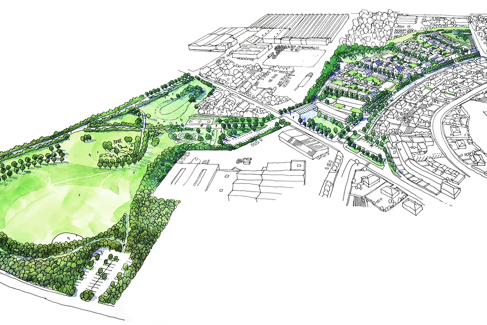
Limoges, 87
Un archipel végétal pour revaloriser le Val d’Aurence